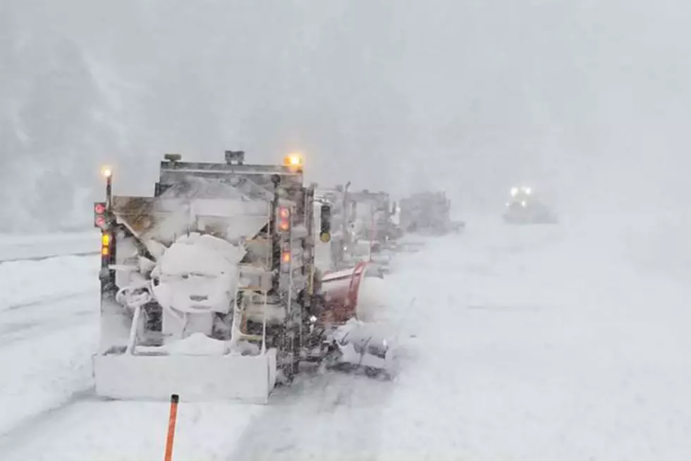
Southeast Wyoming Mountains Could See 1-2 Feet of Snow, 70 MPH Gusts
Heavy snow combined with gusty winds could make mountain travel extremely difficult or impossible in southeast Wyoming Tuesday morning through Wednesday evening, according to the National Weather Service in Cheyenne.
A Winter Storm Watch is in effect for the Sierra Madre and Snowy ranges from 11 a.m. Tuesday to 11 p.m. Wednesday where one to two feet of snow and wind gusts up to 70 mph are possible.
URGENT - WINTER WEATHER MESSAGE
National Weather Service Cheyenne WY
201 AM MST Mon Jan 3 2022

WYZ112-114-040000-
/O.NEW.KCYS.WS.A.0001.220104T1800Z-220106T0600Z/
Sierra Madre Range-Snowy Range-
Including the cities of Centennial and Albany
201 AM MST Mon Jan 3 2022

...WINTER STORM WATCH IN EFFECT FROM TUESDAY MORNING THROUGH
WEDNESDAY EVENING...

* WHAT...Heavy snow possible. Total snow accumulations of 12 to 24
  inches possible. Winds could gust as high as 70 mph.

* WHERE...Sierra Madre and Snowy Ranges to include Centennial and
  Albany.

* WHEN...From Tuesday morning through Wednesday evening.

* IMPACTS...Mountain travel could be extremely difficult or
  impossible due to icy, snow packed roads and near zero
  visibilities in falling and blowing snow. Outdoor recreation
  could become life threatening to those caught unprepared for
  severe winter conditions. Hikers and snowmobilers may easily
  become disoriented. Frostbite and hypothermia can develop
  quickly.

PRECAUTIONARY/PREPAREDNESS ACTIONS...

Monitor the latest forecasts for updates on this situation.

Get our free mobile app
The NWS issued the following briefing Monday morning:
The weather Impact Level for Monday morning through Thursday morning is: Moderate
Here are the current weather event impact highlights:
- High Wind Warnings for wind-prone areas of southeast Wyoming: Now - 5 PM Tuesday with wind gusts up to 75 mph likely
- High Wind Watches:
- Wyoming: Tuesday 4 AM - 5 PM with possible wind gusts up to 65 mph
- Nebraska: Tuesday 9 AM - 5 PM with possible wind gusts up to 65 mph
- Winter Storm Watches: 11 AM Tuesday - 11 PM Wednesday
- Snow totals 12 - 24 inches possible in mountains with wind gusts up to 70 mph
- Widespread snowfall Wednesday
- Very cold wind chills Wednesday night - Thursday morning


Pictures From Wyoming Snowpocalypse 2021
After two days and 30-odd inches of sow, southeast Wyoming was left buried. An in the grand tradition of every generation since the invention of the camera, we took pictures of the snow.
The Blizzard of March 2021 covered up our driveways, fences, and in some cases porches. It trapped up in our homes and canceled our plans.
Here's a quick look around the Cheyenne area from Sunday (March 14) and Monday (March 15).
LOOK: The most expensive weather and climate disasters in recent decades
Stacker ranked the most expensive climate disasters by the billions since 1980 by the total cost of all damages, adjusted for inflation, based on 2021 data from the National Oceanic and Atmospheric Administration (NOAA). The list starts with Hurricane Sally, which caused $7.3 billion in damages in 2020, and ends with a devastating 2005 hurricane that caused $170 billion in damage and killed at least 1,833 people. Keep reading to discover the 50 of the most expensive climate disasters in recent decades in the U.S.
Gallery Credit: KATELYN LEBOFF
More From Laramie Live