Cow Camp Fire Grows to 3,500 Acres – UPDATES
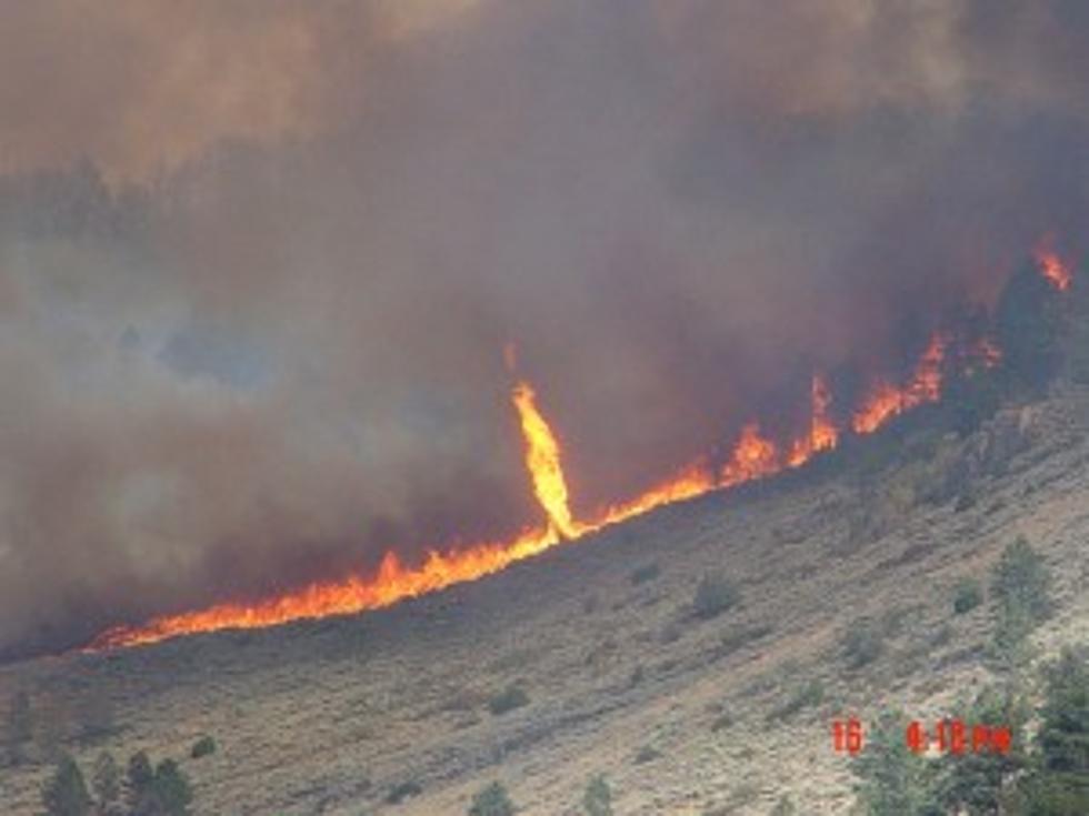
On Monday morning, the Cow Camp fire about five miles southeast of Laramie Peak was burning nearly 100 acres. Last night, the fire was up to 1,500 acres. Today, that same fire has grown to 3,500 burning acres.
The wildfire was triggered by lightning over the weekend and its exponential growth has been fueled by dry lands along with hot and windy weather conditions. As of Tuesday night, the fire was estimated to be only 30% contained. It is burning in close proximity to state lands on the Medicine Bow National Forest and private lands as well.
Currently, the Forest Service is putting more resources into fighting the blaze, and will be sending in more experienced fire managers and bringing in additional firefighting crews. Additional helicopters and air tankers are being employed.
There was hope for firefighters today that the cooler temperatures in the area would aid in fire containment but the low humidity and strong winds are only providing further fuel for the fire which is burning ponderosa pine, brush and grass in the rugged terrain 20 miles northwest of Wheatland.
The fire moved around significantly yesterday with some spotting across fire lines but the largest fire movement was into the wind, to the south, across the Laramie River and onto private land.
As of this morning, there were 120 crew members on scene, including Hot Shot crews and two Type III helicopters. Air attack was provided by a Type I airtanker from Colorado, as well as three single-engine airtankers. A dozer and hand crews are working to establish line, but due to the difficult terrain, forest officials say there is no direct attack on the blaze, but the focus is to establish a larger perimeter, especially to the south.
Ten structures are within two miles of the fire and one unoccupied cabin was burned yesterday. Weather permitting, air attacks will continue today.
Fire location is east of Cottonwood Park Road, County Road 71 and south of County Road 716, the Fletcher Park Road. Both roads are still open, but only necessary travel is encouraged. The North Laramie River Trailhead, northeast of the fire, and the road into the trail are both closed.
Information courtesy of Aaron Voos, Public Affairs Specialist for Medicine Bow-Routt National Forests & Thunder Basin National Grassland.
For regular updates and current information on Wyoming wildfires, you can click on this link from the Wyoming State Forestry Division.
More From Laramie Live


![For Sale: Beef Eater Stainless Steel BBQ Grill [PICTURE]](http://townsquare.media/site/245/files/2012/06/BeefEater.jpg?w=980&q=75)