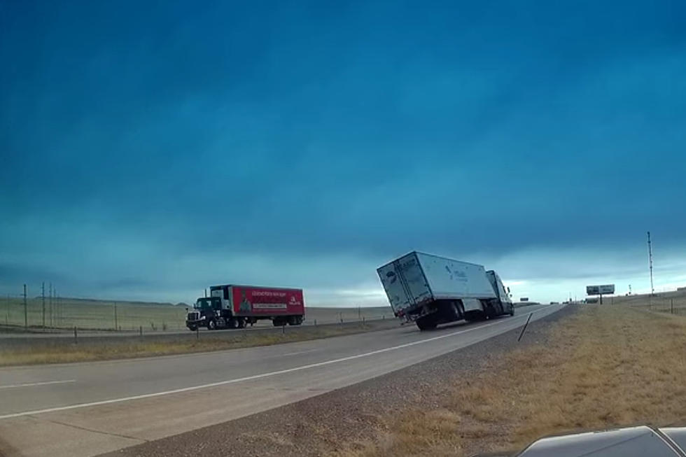
85 MPH Gusts Recorded in SE Wyoming Sunday, More Wind Today
Southeast Wyoming is in for another round of windy weather today, according to the National Weather Service in Cheyenne.
Wind gusts of 85 mph were recorded west of Laramie near Arlington and Elk Mountain Sunday, and the NWS says gusts up to 65 mph are expected today.
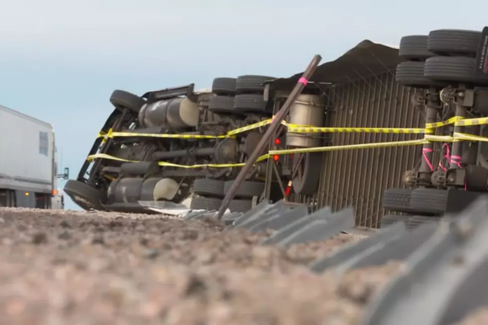
URGENT - WEATHER MESSAGE
National Weather Service Cheyenne WY
1013 AM MST Mon Dec 6 2021

WYZ106-116-117-070400-
/O.CON.KCYS.HW.W.0053.211206T2100Z-211207T0600Z/
Central Laramie Range and Southwest Platte County-
South Laramie Range-South Laramie Range Foothills-
Including the cities of Bordeaux, Buford, Pumpkin Vine, Vedauwoo,
Whitaker, Federal, and Horse Creek
1013 AM MST Mon Dec 6 2021

...HIGH WIND WARNING REMAINS IN EFFECT FROM 2 PM THIS AFTERNOON
TO 11 PM MST THIS EVENING...

* WHAT...West winds 30 to 40 mph with gusts up to 65 mph
  expected.

* WHERE...Central Laramie Range and Southwest Platte County,
  South Laramie Range and South Laramie Range Foothills.

* WHEN...From 2 PM this afternoon to 11 PM MST this evening.

* IMPACTS...Mainly to transportation. Strong cross winds will be
  hazardous to light weight and high profile vehicles, including
  campers and tractor trailers.

PRECAUTIONARY/PREPAREDNESS ACTIONS...

People should avoid being outside in forested areas and around
trees and branches. If possible, remain in the lower levels of
your home during the windstorm, and avoid windows. Use caution if
you must drive.
URGENT - WEATHER MESSAGE
National Weather Service Cheyenne WY
1013 AM MST Mon Dec 6 2021

WYZ104-105-109-115-070300-
/O.CON.KCYS.HW.W.0053.211206T1800Z-211207T0300Z/
Ferris/Seminoe/Shirley Mountains-Shirley Basin-
Central Carbon County-Laramie Valley-
Including the cities of Seminoe Dam, Medicine Bow, Shirley Basin,
Rawlins, Laramie, and Bosler
1013 AM MST Mon Dec 6 2021

...HIGH WIND WARNING REMAINS IN EFFECT UNTIL 8 PM MST THIS
EVENING...

* WHAT...Southwest winds 25 to 35 mph with gusts up to 60 mph
  expected.

* WHERE...Ferris/Seminoe/Shirley Mountains, Shirley Basin,
  Central Carbon County and Laramie Valley.

* WHEN...From 11 AM this morning to 8 PM MST this evening.

* IMPACTS...Mainly to transportation. Strong cross winds will be
  hazardous to light weight and high profile vehicles, including
  campers and tractor trailers.

PRECAUTIONARY/PREPAREDNESS ACTIONS...

People should avoid being outside in forested areas and around
trees and branches. If possible, remain in the lower levels of
your home during the windstorm, and avoid windows. Use caution if
you must drive.
URGENT - WEATHER MESSAGE
National Weather Service Cheyenne WY
1013 AM MST Mon Dec 6 2021

WYZ110-070400-
/O.CON.KCYS.HW.W.0053.000000T0000Z-211207T0600Z/
North Snowy Range Foothills-
Including the cities of Arlington and Elk Mountain
1013 AM MST Mon Dec 6 2021

...HIGH WIND WARNING REMAINS IN EFFECT UNTIL 11 PM MST THIS
EVENING...

* WHAT...Southwest winds 30 to 40 mph with gusts up to 65 mph
  expected.

* WHERE...North Snowy Range Foothills.

* WHEN...From 5 AM early this morning to 11 PM MST this evening.

* IMPACTS...Mainly to transportation. Strong cross winds will be
  hazardous to light weight and high profile vehicles, including
  campers and tractor trailers.

PRECAUTIONARY/PREPAREDNESS ACTIONS...

People should avoid being outside in forested areas and around
trees and branches. If possible, remain in the lower levels of
your home during the windstorm, and avoid windows. Use caution if
you must drive.

The NWS issued the following statement Monday morning:

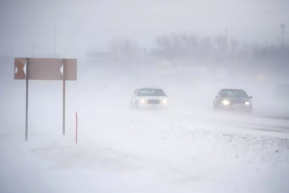
12/06/2021 4am UPDATE: High Wind Warning in effect for the highlighted areas from Laramie Mountain range west towards Rawlins through early to late evening tonight. This also includes the Bordeaux area. Winds will increase first farther west and then increase in coverage and magnitude through mid-day through the afternoon. Winds gusts of 60 to 65 mph will be probable. Winds will slowly decrease through the late evening hours. Be sure to dial 511 or check wyoroad.info for road information prior to traveling.
LOOK: The most expensive weather and climate disasters in recent decades
Gallery Credit: KATELYN LEBOFF
KEEP READING: Get answers to 51 of the most frequently asked weather questions...
More From Laramie Live