Strong Winds, Large Hail Possible In SE Wyoming On Friday
The Cheyenne Office of the National Weather Service says strong winds, large hail, and heavy rain are possible in southeast Wyoming and the Nebraska panhandle on Friday.
The agency posted the following statement on its website on Friday:
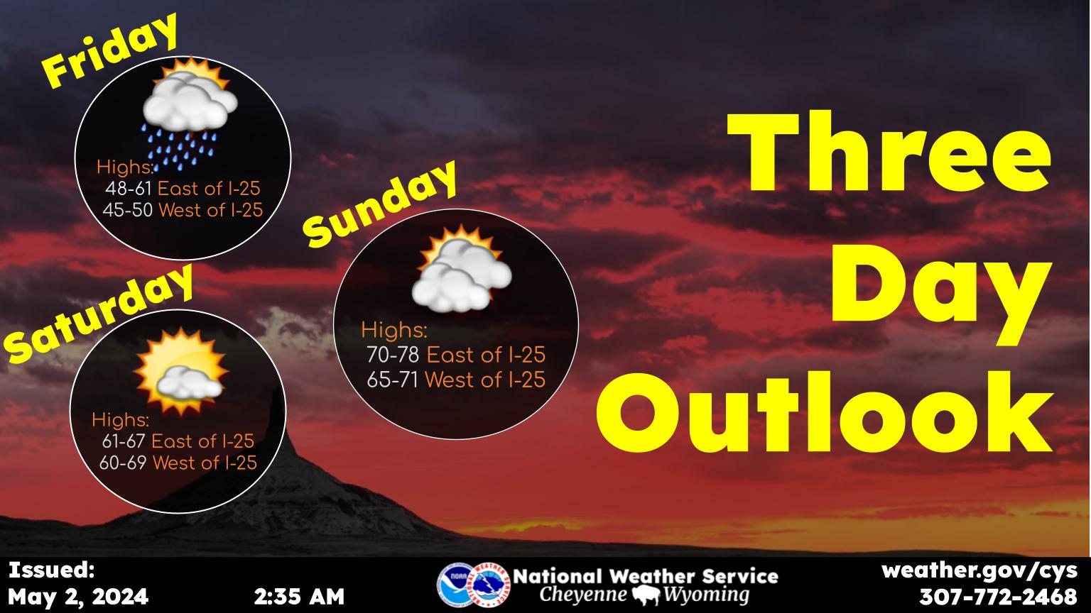
A few rain showers remain around early this morning especially along southern portions of the forecast area near the Colorado border. Showers will clear up by mid-morning, but thunderstorms will return Friday afternoon. Strong to severe storms are possible today with strong winds in excess of 60 MPH and up to quarter size hail being the main threats. Localized flooding is also possible with heavy rain and the potential for training storms this afternoon. Best chance for strong thunderstorms will be located along and southeast of a line from Cheyenne to Chadron. Stay weather aware today in case any storms turn severe and if thunder roars go indoors.
The Most Destructive Tornado in Wyoming's History - July 16, 1979 Cheyenne Tornado
More From Laramie Live