The Cheyenne Office of the National Weather Service is warning about temperatures that could plunge as low as -32 degrees and wind chills that could hit -60 by the middle of this week.

That's according to the the agency' s website. The weather service posted the following early this morning:

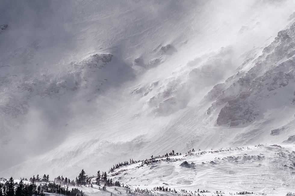
19/340AM: Greetings! Wednesday, 21 December is the official start of winter. Heads up, it will certainly be one to remember for southeast Wyoming and Nebraska Panhandle this year! An arctic boundary currently near the Canadian/U.S. border will make it's way south into our area Wednesday and into Colorado Wednesday night into Thursday. Brutally cold temperatures behind the front, with fairly widespread snow and blowing snow ahead of the front. Dangerously cold temperatures and brutally cold windchill temperatures are forecast across all areas Wednesday night through Friday morning. Windchill temperatures could approach -50 to -60F Wednesday night through Thursday for areas east of the Laramie Range. Temperatures and windchills this cold will injure and threaten your life in very little exposure time! We haven't seen these cold of temperatures for quite a long time, so you will want to prepare now. Take protective actions for livestock and don't forget your outdoor 4 legged friends. Good news? The extreme cold temperatures last only through Friday, before westerly winds return and begin to warm things up Friday afternoon through the weekend.


A  wind chill watch has also been posted for the region:

545 PM December 18: Record-breaking and extremely cold temperatures are expected Wednesday night through Friday morning. Winds gusting as high as 30 MPH combined with temperatures between -20F and -40F will result in dangerous and life threatening wind chills as low as -65F! The period of lowest wind chills will occur Wednesday night and Thursday morning. Wind chills of this magnitude can cause frostbite on exposed skin in less than 5 minutes if precautions are not taken. Hypothermia and death can also occur due to prolonged exposure to the bitter cold temperatures. For the latest updates and details on this extreme cold event, go to  weather.gov/ 

Here is the forecast for Cheyenne:

Today
Sunny, with a high near 37. Windy, with a west wind 15 to 20 mph increasing to 25 to 30 mph in the morning. Winds could gust as high as 40 mph.
Tonight
Mostly cloudy, with a low around 15. Breezy, with a west southwest wind 10 to 20 mph.
Tuesday
Mostly cloudy, with a high near 33. West southwest wind 10 to 15 mph.
Tuesday Night
Mostly cloudy, with a low around 11. Wind chill values between -5 and 5. South southwest wind 10 to 15 mph.
Wednesday
Snow likely after 11am. Partly sunny, with a high near 30. Breezy, with a west southwest wind 15 to 20 mph becoming north northwest in the afternoon. Winds could gust as high as 30 mph. Chance of precipitation is 60%.Night
Snow likely, mainly before 11pm. Widespread blowing snow, mainly after midnight. Mostly cloudy, with a low around -23. Windy. Chance of precipitation is 70%.
Thursday
Widespread blowing snow, mainly before 11am. Mostly sunny and cold, with a high near -8. Blustery.
Thursday Night
Patchy blowing snow before 9pm. Mostly clear, with a low around -17. Blustery.
Friday
Mostly sunny, with a high near 14.
Friday Night
Partly cloudy, with a low around 0.
Saturday
Patchy blowing snow. Mostly sunny, with a high near 34. Breezy.
Saturday Night
Patchy blowing snow. Partly cloudy, with a low around 21. Blustery.
Christmas Day
Patchy blowing snow. Mostly sunny, with a high near 46. Breezy.


Here is the Laramie forecast:


Today
Sunny, with a high near 29. Wind chill values between zero and 10. Windy, with a west wind around 35 mph, with gusts as high as 50 mph.
Tonight
Partly cloudy, with a low around 17. Wind chill values between -5 and zero. Windy, with a west wind 25 to 30 mph, with gusts as high as 45 mph.
Tuesday
Patchy blowing snow between 8am and 9am. Partly sunny, with a high near 29. Wind chill values between zero and 10. Windy, with a west wind 25 to 35 mph, with gusts as high as 50 mph.
Tuesday Night
Patchy blowing snow after 3am. Partly cloudy, with a low around 16. Wind chill values between zero and 5. Windy, with a west southwest wind 20 to 25 mph increasing to 30 to 35 mph after midnight. Winds could gust as high as 50 mph.
Wednesday
Snow, mainly after 11am. Patchy blowing snow. High near 29. Windy, with a west wind 35 to 40 mph decreasing to 25 to 30 mph in the afternoon. Winds could gust as high as 55 mph. Chance of precipitation is 90%.
Wednesday Night
Snow, mainly before 11pm. Areas of blowing snow. Low around -20. Blustery. Chance of precipitation is 80%.
Thursday
Patchy blowing snow. Mostly sunny and cold, with a high near -14. Blustery.
Thursday Night
Patchy blowing snow. Mostly clear, with a low around -18. Blustery.
Friday
Patchy blowing snow before 1pm. Mostly sunny, with a high near 15. Breezy.
Friday Night
A slight chance of snow. Patchy blowing snow after 11pm. Partly cloudy, with a low around 7. Breezy.
Saturday
A slight chance of snow. Patchy blowing snow. Mostly sunny, with a high near 28. Breezy.
Saturday Night
Patchy blowing snow. Partly cloudy, with a low around 21. Breezy.
Christmas Day
Patchy blowing snow. Mostly sunny, with a high near 36. Breezy.

Vehicle Drives Over Lookout Point on Casper Mountain

;

More From Laramie Live