
The Cheyenne Office of the National Weather Service is predicting a cool, wet stretch of weather.

The agency posted the following on its website:

Several rounds of showers are expected to push through the area over the next 48 hours. The first is pushing in from the southwest this morning, with scattered showers expected Sunday under mostly cloudy skies. Another round will develop after sunset, and this round will bring the potential for a few thunderstorms and localized heavy rainfall, mainly in western Nebraska. This round will wrap up early Monday morning, with another lull expected. By Monday morning, expect showers to retreat mainly to Carbon, Converse, and Niobrara counties, but will fill back in to the southeast through the day and continue into Monday evening. Cold air will also push in with this round, allowing snow levels to drop to around 7000 ft Monday morning, then perhaps as low as 5000 ft by the evening. Accumulating snow is expected above 7000 ft and possible between 5000 and 7000 ft, but confidence is lower there. Precipitation will come to an end by Tuesday morning.

Cheyenne, Laramie Forecasts

Cheyenne Forecast

Today
A 20 percent chance of showers before 11am. Patchy fog before noon. Otherwise, mostly cloudy, with a high near 53. South wind 10 to 15 mph.
Tonight
A slight chance of showers between 8pm and 2am. Mostly cloudy, with a steady temperature around 47. Breezy, with a southwest wind 5 to 10 mph becoming west northwest 15 to 20 mph after midnight. Winds could gust as high as 30 mph. Chance of precipitation is 20%.
Monday
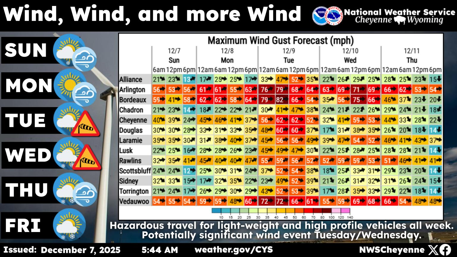
A chance of rain showers before 2pm, then rain likely, possibly mixed with snow showers. Mostly cloudy, with a temperature falling to around 36 by 5pm. Windy, with a northwest wind 25 to 30 mph increasing to 30 to 35 mph in the afternoon. Winds could gust as high as 55 mph. Chance of precipitation is 60%. Little or no snow accumulation expected.
Monday Night
Rain likely, possibly mixed with snow showers, mainly before 8pm. Mostly cloudy, then gradually becoming mostly clear, with a low around 33. Windy, with a northwest wind 30 to 40 mph, with gusts as high as 55 mph. Chance of precipitation is 60%. Little or no snow accumulation expected.
Tuesday
Sunny, with a high near 54. Breezy, with a northwest wind 20 to 25 mph decreasing to 15 to 20 mph in the afternoon. Winds could gust as high as 40 mph.
Tuesday Night
Mostly clear, with a low around 31.
Wednesday
Mostly sunny, with a high near 55.
Wednesday Night
Mostly cloudy, with a low around 31.
Thursday
Mostly sunny, with a high near 54.
Thursday Night
Partly cloudy, with a low around 31.
Friday
Mostly sunny, with a high near 53.
Friday Night
Partly cloudy, with a low around 34.
Saturday
A slight chance of snow showers. Mostly sunny, with a high near 49. Breezy.
Laramie Forecast
Today
A 20 percent chance of showers. Mostly cloudy, with a high near 53. Breezy, with a south southeast wind 20 to 25 mph, with gusts as high as 35 mph.
Tonight
A 30 percent chance of showers, mainly after 5am. Mostly cloudy, with a low around 36. Breezy, with a south wind 10 to 15 mph becoming west 20 to 25 mph after midnight. Winds could gust as high as 35 mph.
Monday
Snow showers likely, possibly mixed with rain before 2pm, then snow showers. Temperature falling to around 31 by 11am. Windy, with a northwest wind 25 to 35 mph, with gusts as high as 50 mph. Chance of precipitation is 80%. New snow accumulation of 1 to 2 inches possible.
Monday Night
Snow showers, mainly before 11pm. Low around 29. Windy, with a northwest wind 25 to 35 mph, with gusts as high as 50 mph. Chance of precipitation is 80%. New snow accumulation of 1 to 2 inches possible.
Tuesday
Sunny, with a high near 48. West wind around 15 mph, with gusts as high as 25 mph.
Tuesday Night
Mostly clear, with a low around 30.
Wednesday
Partly sunny, with a high near 50.
Wednesday Night
Mostly cloudy, with a low around 30.
Thursday
Mostly sunny, with a high near 48.
Thursday Night
Partly cloudy, with a low around 30.
Friday
Mostly sunny, with a high near 48.
Friday Night
A slight chance of snow showers. Partly cloudy, with a low around 31. Breezy.
Saturday
A chance of snow showers. Mostly sunny, with a high near 43. Breezy.

LOOK: These Photos Show Why ’70s Cars Were Something Special (and Obviously Better)

Big, bold, and built different — these ’70s cars looked and felt like nothing on the road today. Take a ride back and see them in their prime. [And we did our best to identify the models and dates, so if we got it wrong, gearheads, don’t come after us!]

Gallery Credit: Stephen Lenz