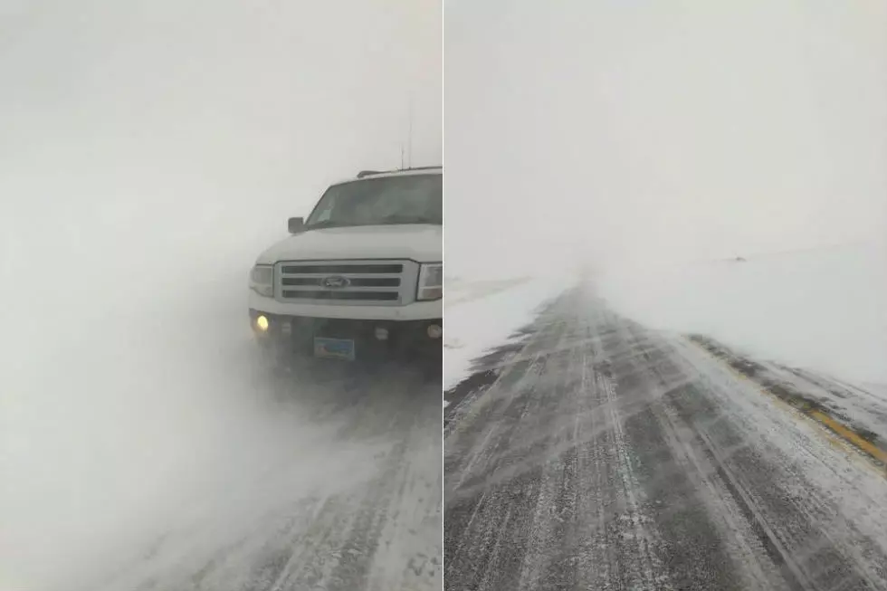
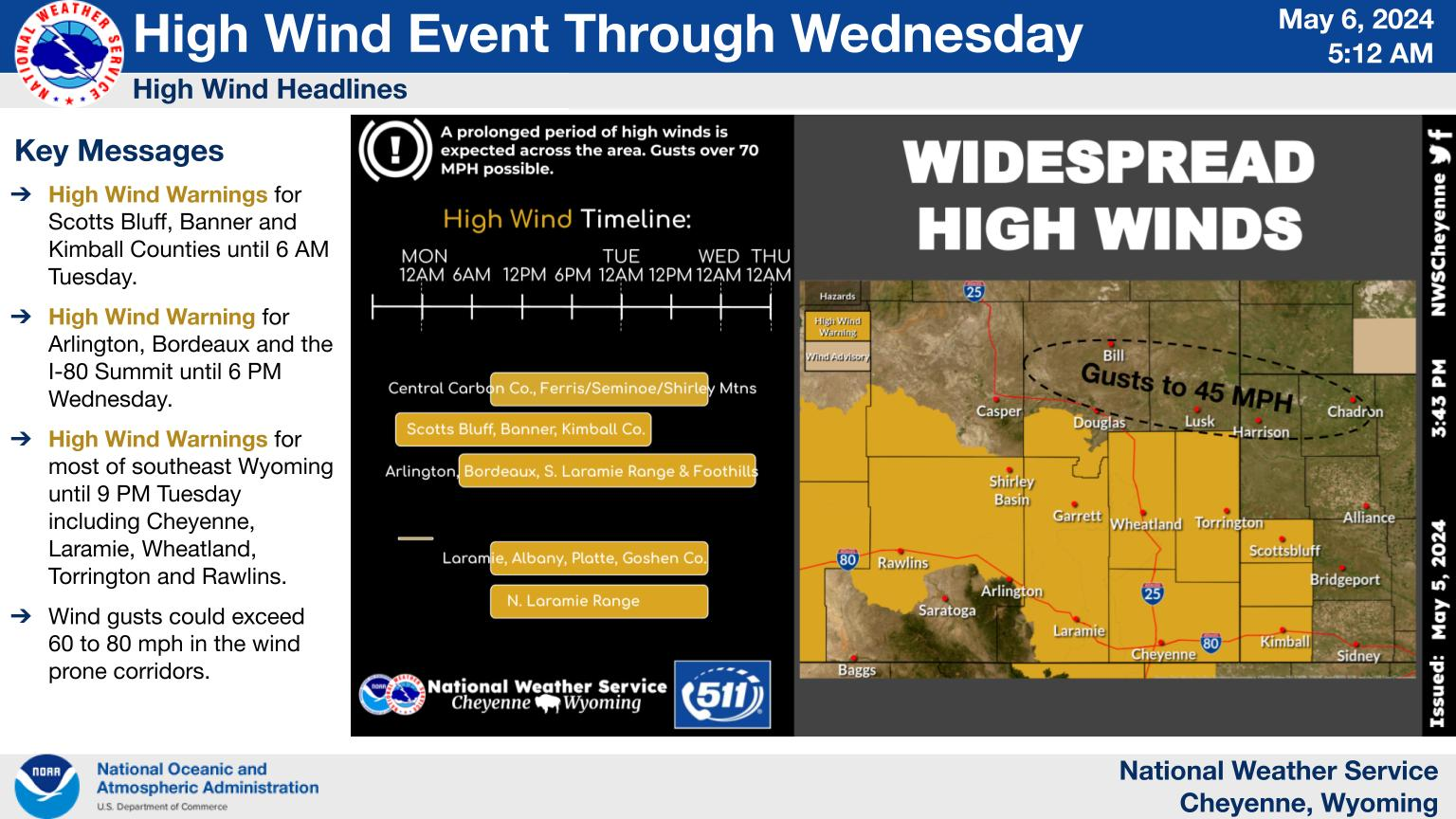
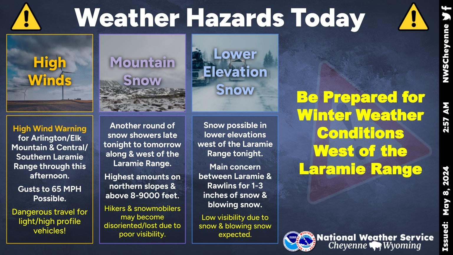
While Cheyenne and Laramie aren't facing the kind of double-digit subzero temperatures seen over the weekend, they are facing high wind and winter weather advisories at least until 11 a.m. on Thursday.

Southeast Wyoming in general can expect more snow over the next few days.

That's according to the Cheyenne Office of the National Weather Service.

The agency posted the following on its website just before 6 a.m. this morning [Jan.17]:

Laramie Valley has been added to the High Wind Warning. Next cold front approaching from the west will bring strong winds, heavy mountain snow and blowing snow to much of southeast Wyoming today through Thursday. High Wind Warnings currently in effect through Thursday late morning. Winter Weather Advisories for snow and blowing snow for the areas highlighted in purple are in effect through Thursday evening. Snow accumulations of 1-3 inches are expected in these areas. Finally, Winter Storm Warnings are in effect for the Snowy and Sierra Madre Ranges through Friday morning, where we could see new snow accumulation of 2-3 feet. Travel likely to be impacted on Interstate 80 along and west of Cheyenne, as well as Interstate 25 from the Colorado state line to near Douglas. Stay tuned!

Got some snow ahead for most of southeast Wyoming and Nebraska Panhandle. Next cold front is approaching from the west this morning. We are expecting snow to begin out near Rawlins early this morning, spreading east this afternoon. The Snowy and Sierra Madre Ranges are under Winter Storm Warnings today through Friday morning where we are expecting up to 3 feet of new snow accumulations. Winter Weather Advisories are in effect for snow and blowing snow through Thursday for much of southeast Wyoming. Not a lot of snow is expected, maybe 1-2 inches, but with the strong winds, it will cause blowing snow, slick roads and hazardous driving conditions. Snow expected to come to an end outside the mountains late Thursday night, but will continue in the mountains into Friday evening. Stay tuned!

Laramie and Cheyenne Forecasts

Cheyenne Forecast

Today
A 20 percent chance of snow. Mostly cloudy, with a high near 39. Breezy, with a southwest wind 15 to 20 mph, with gusts as high as 30 mph.
Tonight
Partly cloudy, with a low around 19. Windy, with a west wind 15 to 20 mph increasing to 25 to 30 mph after midnight. Winds could gust as high as 40 mph.
Thursday
A 50 percent chance of snow. Partly sunny, with a temperature rising to near 30 by 8am, then falling to around 6 during the remainder of the day. Wind chill values between -5 and -15. Windy, with a west wind 25 to 30 mph becoming north 20 to 25 mph in the afternoon. Winds could gust as high as 45 mph.
Thursday Night
A 20 percent chance of snow before 11pm. Partly cloudy, with a low around -2. Wind chill values between -10 and -15. North wind 5 to 15 mph becoming west after midnight.
Friday
Mostly sunny, with a high near 23. South wind 5 to 10 mph.
Friday Night
Partly cloudy, with a low around 6.
Saturday
Partly sunny, with a high near 38.
Saturday Night
Mostly cloudy, with a low around 23.
Sunday
Partly sunny, with a high near 42. Breezy.
Sunday Night
Mostly cloudy, with a low around 24.
Monday
Partly sunny, with a high near 44.
Monday Night
Partly cloudy, with a low around 23.
Tuesday
Mostly sunny, with a high near 41.
Laramie Forecast:
Today
A 50 percent chance of snow. Patchy blowing snow. Mostly cloudy, with a high near 35. Windy, with a west southwest wind 20 to 30 mph, with gusts as high as 40 mph.
Tonight
A 20 percent chance of snow. Patchy blowing snow after midnight. Mostly cloudy, with a low around 19. Breezy, with a southwest wind 20 to 25 mph, with gusts as high as 35 mph.
Thursday
Snow likely. Widespread blowing snow, mainly before noon. Mostly cloudy, with a temperature rising to near 30 by 11am, then falling to around 16 during the remainder of the day. Windy, with a west wind 30 to 35 mph becoming north northwest 20 to 25 mph. Winds could gust as high as 50 mph. Chance of precipitation is 60%. New snow accumulation of less than a half inch possible.
Thursday Night
A 20 percent chance of snow before 11pm. Mostly cloudy, with a low around 0. Wind chill values between -5 and zero. West wind 5 to 10 mph.
Friday
Partly sunny, with a high near 29. West wind around 5 mph.
Friday Night
Mostly cloudy, with a low around 11.
Saturday
Partly sunny, with a high near 39.
Saturday Night
Mostly cloudy, with a low around 21.
Sunday
Partly sunny, with a high near 40.
Sunday Night
Mostly cloudy, with a low around 20.
Monday
Partly sunny, with a high near 41.
Monday Night
Partly cloudy, with a low around 16.
Tuesday
Mostly sunny, with a high near 35.

10 of Wyoming's Most Dangerous Animals

Wyoming is home to some pretty epic creatures. The pronghorn is the second fastest land animal in the world, second only to the cheetah -- and it's worth noting that while the cheetah can spring faster, the pronghorn can sustain it's top speed much farther. And while we do have plenty of cute and cuddly creatures (llike the nothern saw-whet owl) there are plenty of things that'll kill ya. Might want to think twice about moving here.

More From Laramie Live