Canva
Canva
loading...

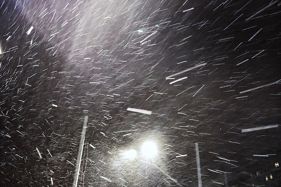
Cheyenne and Laramie residents can expect strong winds and possibly some snow this weekend, according to the Cheyenne Office of the National Weather Service.

Both communities are under a High Wind Warning for Saturday.

Much heavier snow is expected in the Snowy Range and Sierra Madre mountains, according to the agency. Some higher elevations could get up to four feet of snow.

The agency posted the following on its website:

Winter Storm Warnings remain in effect for the Snowy and Sierra Madre Ranges in south central Wyoming today through Monday. Looks like these two mountain ranges are going to get pounded with very heavy snow. Hunters, hikers and snow mobilers stand a HIGH risk of becoming disoriented/lost with this heavy snow, strong winds and blowing snow. Winter Weather Advisories have been posted for southwest Carbon County the upper North Platte River valley, where snow accumulations of 3 to 5 inches are expected.

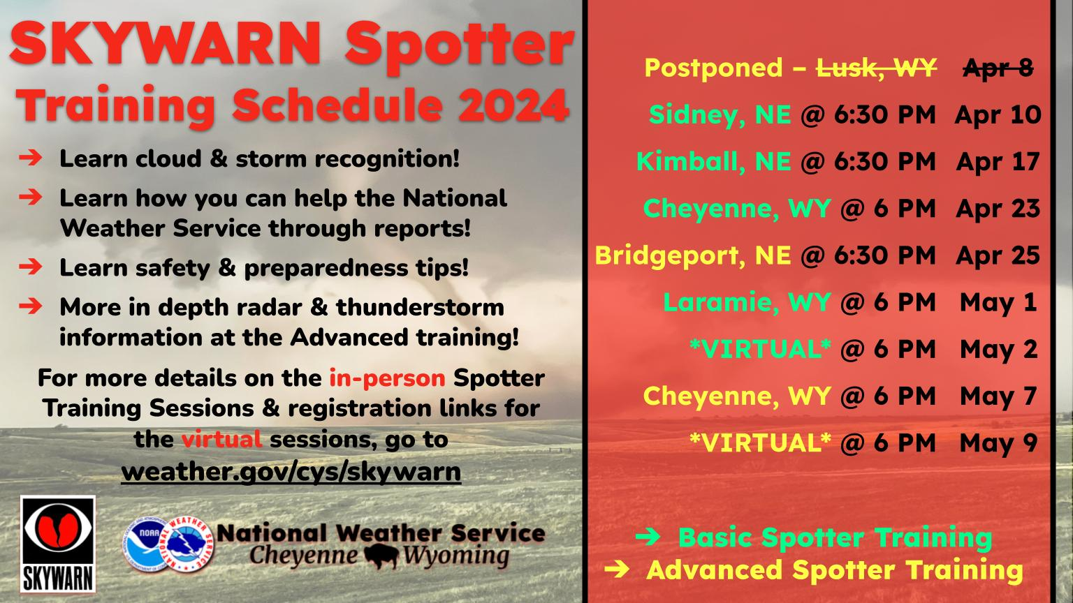
Here is the Cheyenne forecast:

Today
A 20 percent chance of snow after 4pm. Mostly sunny, with a temperature rising to near 29 by noon, then falling to around 24 during the remainder of the day. Windy, with a west northwest wind 40 to 45 mph decreasing to 35 to 40 mph in the afternoon. Winds could gust as high as 65 mph.
Tonight
A 30 percent chance of snow, mainly after 11pm. Mostly cloudy, with a low around 22. Windy, with a west wind 35 to 40 mph, with gusts as high as 55 mph.
Sunday
A 40 percent chance of snow before 11am. Mostly sunny, with a high near 34. Windy, with a northwest wind 30 to 40 mph, with gusts as high as 55 mph.
Sunday Night
Mostly cloudy, with a low around 29. Windy, with a west wind 30 to 35 mph increasing to 40 to 45 mph after midnight. Winds could gust as high as 60 mph.
Monday
Mostly sunny, with a high near 46. Windy, with a west wind 40 to 45 mph decreasing to 35 to 40 mph in the afternoon. Winds could gust as high as 65 mph.
Monday Night
Mostly clear, with a low around 32. Windy.
Tuesday
Sunny, with a high near 51. Breezy.
Tuesday Night
Mostly clear, with a low around 34.
Wednesday
Mostly sunny, with a high near 58. Breezy.
Wednesday Night
Partly cloudy, with a low around 35. Breezy.
Thursday
Mostly sunny, with a high near 52. Breezy.
Thursday Night
Partly cloudy, with a low around 28.
Friday
A slight chance of snow. Mostly sunny, with a high near 46.
Here is the forecast for Laramie:
Today
A 30 percent chance of snow after 4pm. Mostly sunny, with a high near 23. Wind chill values between zero and 5. Windy, with a west wind around 45 mph, with gusts as high as 60 mph.
Tonight
Snow likely, mainly after 11pm. Widespread blowing snow, mainly after 2am. Mostly cloudy, with a temperature rising to around 28 by 2am. Wind chill values between zero and 10. Windy, with a west wind around 45 mph, with gusts as high as 65 mph. Chance of precipitation is 60%. New snow accumulation of 1 to 2 inches possible.
Sunday
A 50 percent chance of snow before 11am. Widespread blowing snow, mainly before noon. Partly sunny, with a steady temperature around 22. Wind chill values between -5 and 5. Windy, with a west northwest wind 40 to 45 mph, with gusts as high as 65 mph.
Sunday Night
A 30 percent chance of snow, mainly before 11pm. Areas of blowing snow before 4am. Partly cloudy, with a low around 27. Windy, with a west wind 40 to 45 mph, with gusts as high as 65 mph.
Monday
Mostly sunny, with a high near 39. Windy, with a west wind 40 to 45 mph, with gusts as high as 65 mph.
Monday Night
Mostly clear, with a low around 29. Windy.
Tuesday
Sunny, with a high near 44. Breezy.
Tuesday Night
Partly cloudy, with a low around 34. Breezy.
Wednesday
Mostly sunny, with a high near 49. Breezy.
Wednesday Night
Partly cloudy, with a low around 34. Breezy.
Thursday
Mostly sunny, with a high near 45. Breezy.
Thursday Night
Partly cloudy, with a low around 28.
Friday
A slight chance of snow. Mostly sunny, with a high near 41. Breezy.

Must Read Books From Wyoming Authors

Gallery Credit: Glenn Woods