Hurricane-Force Gusts Possible in Southeast Wyoming This Weekend
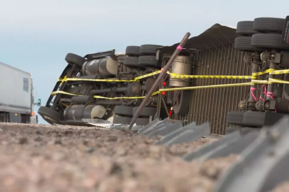
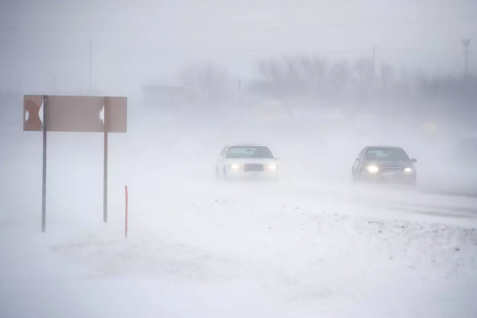
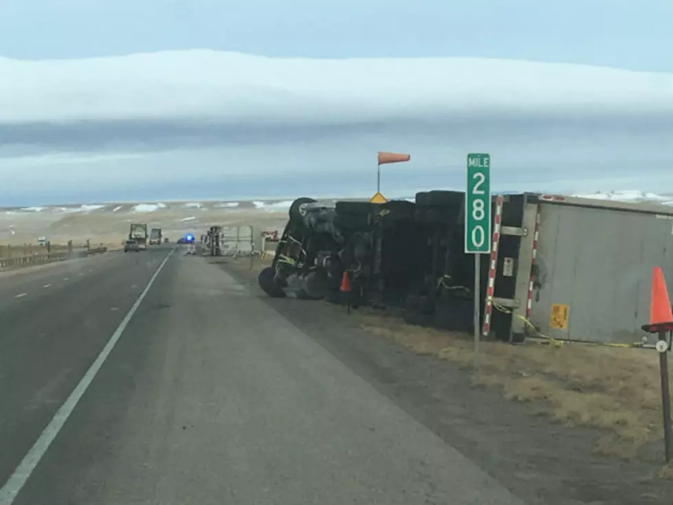
Portions of Interstate 25 and Interstate 80 in southeast Wyoming could see 75 mph wind gusts Saturday morning through early Sunday morning, according to the National Weather Service in Cheyenne.
The agency issued the following statement Thursday afternoon:

2PM Thursday 12/2 – High Wind Watches are in effect for portions of southeast Wyoming Saturday morning through early Sunday morning where wind gusts between 65 and 75 MPH are possible. Peak windy period will likely be Saturday 5 PM to midnight. Dangerous Travel Possible for Light Weight and High Profile Vehicles! For road conditions: wyoroad.info or dial 511; and for your latest forecast: weather.gov/CYS.

URGENT - WEATHER MESSAGE
National Weather Service Cheyenne WY
1246 PM MST Thu Dec 2 2021

WYZ106-110-031200-
/O.NEW.KCYS.HW.A.0045.211204T1200Z-211205T1200Z/
Central Laramie Range and Southwest Platte County-
North Snowy Range Foothills-
Including the cities of Bordeaux, Arlington, and Elk Mountain
1246 PM MST Thu Dec 2 2021

...HIGH WIND WATCH IN EFFECT FROM LATE FRIDAY NIGHT THROUGH LATE
SATURDAY NIGHT...

* WHAT...West winds 40 to 50 mph with gusts up to 75 mph
  possible.

* WHERE...Central Laramie Range and Southwest Platte County and
  North Snowy Range Foothills.

* WHEN...From late Friday night through late Saturday night.

* IMPACTS...Mainly to transportation. Strong cross winds will be
  hazardous to light weight and high profile vehicles, including
  campers and tractor trailers.

PRECAUTIONARY/PREPAREDNESS ACTIONS...

Monitor the latest forecasts and warnings for updates on this
situation. Fasten loose objects or shelter objects in a safe
location prior to the onset of winds.
URGENT - WEATHER MESSAGE
National Weather Service Cheyenne WY
1246 PM MST Thu Dec 2 2021

WYZ116-117-031200-
/O.NEW.KCYS.HW.A.0045.211205T0000Z-211205T1500Z/
South Laramie Range-South Laramie Range Foothills-
Including the cities of Buford, Pumpkin Vine, Vedauwoo, Whitaker,
Federal, and Horse Creek
1246 PM MST Thu Dec 2 2021

...HIGH WIND WATCH IN EFFECT FROM SATURDAY AFTERNOON THROUGH
SUNDAY MORNING...

* WHAT...West winds 40 to 50 mph with gusts up to 70 mph
  possible.

* WHERE...South Laramie Range and South Laramie Range Foothills.

* WHEN...From Saturday afternoon through Sunday morning.

* IMPACTS...Mainly to transportation. Strong cross winds will be
  hazardous to light weight and high profile vehicles, including
  campers and tractor trailers.

PRECAUTIONARY/PREPAREDNESS ACTIONS...

Monitor the latest forecasts and warnings for updates on this
situation. Fasten loose objects or shelter objects in a safe
location prior to the onset of winds.
URGENT - WEATHER MESSAGE
National Weather Service Cheyenne WY
1246 PM MST Thu Dec 2 2021

WYZ107-115-118-031200-
/O.NEW.KCYS.HW.A.0045.211205T0300Z-211205T1200Z/
East Platte County-Laramie Valley-Central Laramie County-
Including the cities of Wheatland, Guernsey, Laramie, Bosler,
and Cheyenne
1246 PM MST Thu Dec 2 2021

...HIGH WIND WATCH IN EFFECT FROM SATURDAY EVENING THROUGH LATE
SATURDAY NIGHT...

* WHAT...West winds 40 to 50 mph with gusts up to 65 mph
  possible.

* WHERE...East Platte County, Laramie Valley and Central Laramie
  County.

* WHEN...From Saturday evening through late Saturday night.

* IMPACTS...Mainly to transportation. Strong cross winds will be
  hazardous to light weight and high profile vehicles, including
  campers and tractor trailers.

PRECAUTIONARY/PREPAREDNESS ACTIONS...

Monitor the latest forecasts and warnings for updates on this
situation. Fasten loose objects or shelter objects in a safe
location prior to the onset of winds.
Be sure to dial 511 or check wyoroad.info for road information prior to traveling.
LOOK: The most expensive weather and climate disasters in recent decades
Gallery Credit: KATELYN LEBOFF
LOOK: See how much gasoline cost the year you started driving
Gallery Credit: Sophia Crisafulli
More From Laramie Live